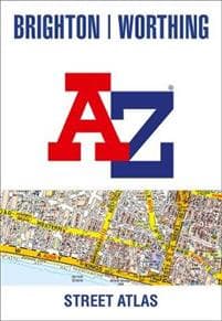
Brighton and Worthing A-Z Street Atlas
171 kr
171 kr
Tor, 12 jun - ons, 18 jun
Säker betalning
14-dagars öppet köp
Säljs och levereras av
AdlibrisProduktbeskrivning
Printed in full-colour, paperback format, this atlas contains 41 pages of continuous street mapping.
The main mapping extends to Hove, Newhaven, Shoreham-by-Sea at a scale of 4 inches to 1 mile, featuring postcode districts, one-way streets, park and ride sites, and safety camera locations. Areas covered include:
- Findon
- Durrington
- Goring-by-Sea
- Lancing
- Southwick
- Patcham
- Falmer
- Woodingdean
- Saltdean
- Rottingdean
- Peacehaven
Separate coverage of Lewes, Seaford, Steyning, Bramber and Upper Beeding is provided.
The large-scale street map of Brighton city centre - at a scale of 8 inches to 1 mile - includes:
- Postcode map of the Brighton area
- Road map of the Brighton area
A comprehensive index lists streets, selected flats, walkways and places of interest, place, area and station names. Additional healthcare (hospitals, walk-in centres and hospices) are indexed as well.
Artikel.nr.
ec67cc51-46da-40ef-a997-a81294816697
Brighton and Worthing A-Z Street Atlas
171 kr
171 kr
Tor, 12 jun - ons, 18 jun
Säker betalning
14-dagars öppet köp
Säljs och levereras av
AdlibrisLiknande toppsäljare

POP MART Labubu The Monsters – Exciting Macaron Blind Box 17 cm Vinylfigur | Samlarobjekt | Designer Toy | Originalprodukt
179 kr
")
1 st POP MART Labubu 3.0 Big into Energy Blind Box Figur – The Monsters Vinyl Plysch Hänge 17 cm (slumpad färg, enkel pack)
199 kr
")
1 st POP MART Labubu The Monsters Exciting Macaron Plyschfigur Leksak Blind Box (slumpad färg, 17 cm, 1 pack)
179 kr

12-pack Oral-B Kompatibla Tandborsthuvuden
89 kr
")
Sony PlayStation DualSense - White (PS5)
639 kr
Tidigare lägsta pris:
679 kr

Apple AirPods 4 Active Noise Cancellation Wireless In-ear
2 096 kr
Tidigare lägsta pris:
2 099 kr

Vattenfontän solcellsdriven 16 cm solcellsfontän vatten fontän utomhus Svart
149 kr
Tidigare lägsta pris:
179 kr

INF Cocktail set Dubbel shaker 750ml Rostfritt stål Silver 10 delar
289 kr
Tidigare lägsta pris:
385 kr

INF Poolfilter för MSPA uppblåsbara pooler FD2089 4-pack
265 kr
Tidigare lägsta pris:
353 kr

INF 6-pack trimmerspolar med trimmertråd och lock RYOBI grästrimmer
142 kr
Tidigare lägsta pris:
189 kr
Rekommendationer för dig

Solfontän Solcellsdriven Fontän vattenfontän / Vattenpump
149 kr
Tidigare lägsta pris:
299 kr

Playstation 5 DualSense Controller Midnight Black
639 kr
Tidigare lägsta pris:
679 kr

POP MART Labubu The Monsters Big into Energy 17 cm
199 kr

INF Tillbehör för Roborock S5/S6 modeller 7 delar
149 kr
Tidigare lägsta pris:
199 kr

iPhone Snabbladdare USB-C PD 3.0. 20W Strömadapter + Kabel
117 kr

INF TYPE-C Dubbel SD/TF-kortläsare för snabb dataöverföring 0
79 kr

Apple Iphone 16e 128GB Svart Svart
7 390 kr

UNIQ XL Hollywood Spegel med 15 LED-lampor och touch-funktion - sminkspegel med belysning - hollywoodspegel
795 kr
Tidigare lägsta pris:
895 kr

Laddare för iPhone 15 / iPhone 16 + 2M kabel Snabbladdare USB-C till USB-C
99 kr

Samsung Galaxy Tab A9+ Wifi 64GB Svart grafit
1 980 kr